Good to Know.
Facts and Figures


Graubünden is the largest region in Switzerland, making up 17.2 % of Switzerland’s total land area. Graubünden is also the most sparsely populated region with only 202'538 inhabitants – Switzerland has 8.7 million in total.
| Area: | 7105 km2 |
|---|---|
| Population: | 202'538 |
| Capital: | Chur |
| Languages: | German (73 %), Romansh (14 %), Italian (13 %) |

Nature
| Valleys: | 150 |
| Lakes: | 1038 |
| Mountain peaks: | 937 |
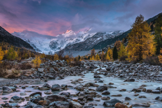
| Highest point: | Piz Bernina at 4049 m above sea level |
| Lowest point: | San Vittore (borders with Ticino) 279 m above sea level |
Sport and Activites
| Hiking trails: | 11'000 km |
|---|---|
| Bike trails: | 4500 km |
| Golf courses: | 15 |
| Ski slopes: | 2000 km |
| Cross-country skiing trails: | 1700 km |
Important Phone Numbers
| Police: | Tel. 117 |
|---|---|
| Fire department: | Tel. 118 |
| Ambulance/rescue: | Tel. 144 |
| Swiss Air Rescue REGA : | Tel. 1414 |
| Breakdown Service TCS Touring Club Switzerland: | Tel. 140 |
| Weather forecast: | Tel. 162 |
| Avalanche bulletin: | Tel. 187 |
| Road conditions: | Tel. 163 |
| General information: | Tel. 1811 |


