53 Bernina-Tour


Show all 30 images

Details
Description
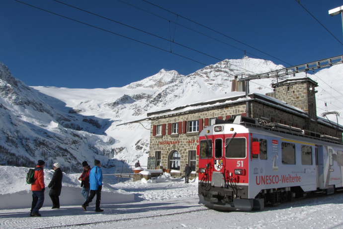
The tour begins in Poschiavo, at 1,021 metres above sea level, and leads along the UNESCO World Heritage line of the Rhaetian Railway up to the Bernina Pass at 2,328 metres, via the Cavaglia Glacier Garden with its glacial mills and Alp Grüm, giving the first view of the eastern flanks of the Bernina massif. The wide, flat path along the Lago Bianco gives runners the opportunity to take a breather and loosen up their muscles for the further 700 metres of altitude up to the summit station of the Diavolezza gondola with a breathtaking view of the Pers and Morteratsch glaciers.
From the summit station of the Diavolezza gondola you take the gondola back to the valley station or walk, past the Lej da Diavolezza lake, down to the valley station. After crossing the main road, the steep ascent to the Fuorcla Pischa at 2,835 metres begins. On the descent to Pontresina, you can enjoy refreshments in the Chamanna Paradies hut or the Bergrestaurant Alp Languard. Once you have left the mountaineering village of Pontresina, on the same level as the train station you enter the pretty Val Roseg. In front of the Hotel Restaurant Val Roseg, the path turns right and climbs up to the Fuorcla Surlej, offering views of the Vadret da Roseg lake and the Bianco ridge of the Piz Bernina on the left. After the Fuorcla Surlej, the trail descends 200 vertical metres to the tiny Lej da la Fuorcla lake and traverses the mountain flank to Alp Prasüra and down to the culture village of Sils.
Next, the route leads past the church in Sils Baselgia to the left side of the valley along the Via Engiadina, past the Heidi village of Grevasalvas to Maloja. After crossing the Lägh da Cavloc in the direction of the Forno glacier, you reach the turn-off to the left in the direction of the Muretto Pass at 2,559 metres, leading along an ancient trail that once linked Switzerland and Italy. A wide path proceeds down to the Alpe dell’Oro above the Italian village of Chiareggio. After traversing the meadows of Palolungo, Paluetto abd Barchetto, you reach the Lago Palù at 1,947 metres above sea level. From there, the route climbs once again over the Bocchel de Torno and through extensive forests and over alpine meadows, past Campascio and Musella down to the dam of Lago Campomoro. Over the dam and up, past the lovely little lakes, you reach the Passo Canciano, which takes you back across the border into Switzerland. Here, the steep descent, past Selva, to Poschiavo begins.
More information
Engadin Tourismus AG
Via Maistra 1
CH-7500 St. Moritz
Phone: +41 81 830 00 01
E-mail: allegra@engadin.ch
Internet: www.engadin.ch
Booking
Eurotrek AG
Zürcherstrasse 42
CH-8103 Unterengstringen
Phone: +41 44 316 10 00
E-mail: eurotrek@eurotrek.ch
Internet: www.eurotrek.ch/en/hiking-bernina-tour
Geheimtipp
Sicherheitshinweis
In the mountains, mobile phone reception cannot always be guaranteed.
Ausrüstung
Directions
Directions
Public Transport
Responsible for this content: Engadin Tourismus AG.

This website uses technology and content from the Outdooractive platform.


