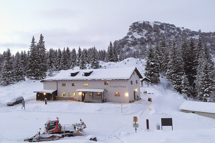
Bargis
Simple
2.5 km
0:45 h
31 mhd
31 mhd


Show all 11 images

From this approximately 45-minute walk you can enjoy the sight of the high valley.
Best Season
Jan
Feb
Mär
Apr
Mai
Jun
Jul
Aug
Sep
Okt
Nov
Dez
Start
Flims, Fidaz, Bargis Restaurant
Destination
Bargis Restaurant
Coordinates
46.855926, 9.326085
Details
Description
The high valley of Bargis is located between the Flimserstein and the Piz Mirutta, which is upstream of the Ringelspitz. Through the high valley with its lush herb meadows, dreamy wooden stables and impressive rock walls flows a refreshing stream, which invites you to linger and relax.This easy, around 3 km long circular walk across the plateau of Bargis can be easily done with the stroller. Start and finish is the Berghaus Bargis.
While at higher altitudes there is at best already snow, the trails in the valley are still free of snow. Our interactive snow depth map helps you to plan your tour. Here you can see at a glance at www.flims.com/schneesituation where you can already expect snow on the paths and trails and where you can still be on the road without getting cold feet.
Geheimtipp
The home-style cuisine in Bargis with local dishes is famous for the crispy Rösti, the Bündner Salsiz or even for the delicate plum and apricot variety.
Sicherheitshinweis
In uncertain weather conditions, the tour should not be started. Weather reversals in the mountains are common.
Ausrüstung
Good mountain boots and rain protection strongly recommended.
Directions
Flims - Fidaz - Bargis
Directions
Public Transport
Stop: Bargis by Postbus from Chur to Flims, and then by public Flims Laax Falera Shuttle towards Fidaz.
Anreise Information
Is a private road - must not be driven. By car Motorway A13 from Zurich, exit 18, Flims.
Parking
12 parking spaces at the Milky Way Fidaz or further towards Bargis. Parking Fidaz forest edge has 30 parking spaces.
Responsible for this content: Flims Laax Falera Management Ltd..

This website uses technology and content from the Outdooractive platform.
