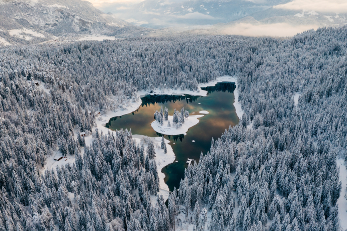
Big Caumasee trail

Medium
5.5 km
1:00 h
106 mhd
102 mhd


Show all 5 images

Through the idyllic Flimserwald and around the Caribbean of the Alps, Lake Cauma.
Best Season
Jan
Feb
Mär
Apr
Mai
Jun
Jul
Aug
Sep
Okt
Nov
Dez
Start
Car parking playground Flims Waldhaus
Destination
Car parking playground Flims Waldhaus
Coordinates
46.826423, 9.292948
Details
Description
A popular jogging trail in the middle of the Flimserwald and around the Caumasee in the middle of nature and still not far from the village.
While there may already be snow at higher altitudes, the paths in the valley are still snow-free. Our interactive snow depth map will help you plan your tour. Here you can see at a glance at www.flims.com/schneesituation where you can expect snow on the paths and trails and where you can still go without getting cold feet.
Geheimtipp
Especially beautiful is the trail early in the morning in all peace, when the water is still smooth and not infrequently steam rises over the lake.
Sicherheitshinweis
On beautiful days and especially on weekends, many pedestrians and bathers can be expected during the day.
Ausrüstung
Usual running equipment is sufficient.
Directions
Playground Flims Waldhaus - eastern area of Lake Cauma - southern shore of Lake Cauma - Lac Prau Tulerigt - sports center Prau la Selva - Camping Flims - parking Lake Cauma - playground Flims Waldhaus
Directions
Public Transport
Train to Chur, then PostBus to Flims Waldhaus Post.
Anreise Information
By car motorway A13 from Zurich, exit 18 Flims.
Parking
Recommended: Car park Stenna, Flims cable cars, chargeable.
Parking playground Flims Waldhaus, also chargeable.
Responsible for this content: Flims Laax Falera Management Ltd..
This content has been translated automatically.

This website uses technology and content from the Outdooractive platform.


