Hike in the moor from St. Antönien to Stels


Show all 7 images

Details
Description
The path now leads past the mountain lodge 'Berggasthaus zum See' and on the road down to the bus stop 'Mottis' and the mountain lodge 'Mottis'. In both lodges you can stop for refreshments and also hire a scooter to ride down to Schiers.
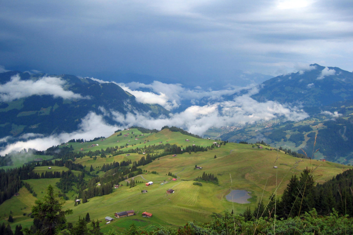
Carry on in the direction of 'Stels'. Loose forest with fern, berries and in between beautiful moor which in autumn look the most colourful. The trail is well-signalled with posts and marks. In the background you can now see the first mountain peaks. Be careful when you are balancing over the various lose boards and roots. From the point where you get our of the forest there is a panoramic view from the mountain 'Schesaplana' to the Austrian mountains. You continue the walk through the meadows half right up the hill to the signpost 'Stelserberg' from where you walk straight forward to get to the 'Untersäss' with a big well. The marked posts lead you safely across two brooks to the junction with the upper trail coming from Valpun. You walk along the contour line to point 1826. From here a trail over the meadows leads you down to 'Stelserberg'. A signpost points to the small lake 'Stelsersee' and this little detour it worth it. It is the highest location in Europe where you can admire the beautifully tender white waterlilies.
Directions
St.Antönien Platz 1414m - Aschüel 1610m - Untersäss 1774m - 1826m - Stelsersee 1668m - Stels Mottis (Stelserberg) 1460m
The path follows the trail marking "white-red-white" and is not specially marked.
Directions
Public Transport
Anreise Information
Parking
Responsible for this content: Prättigau Marketing.
This content has been translated automatically.

This website uses technology and content from the Outdooractive platform.


