Panoramic trail Haldenstein - Felsberg


Show all 6 images

Details
Description
This leisurely circular hike leads along wide natural paths along the Calanda massif. The hike starts from the Obere Au and leads along the Rhine to Haldenstein, where the path leads up to the Panorama Trail. Optionally, the tour can also be started from Haldenstein.
Closure of the finish slope Arabüehl: Please note that the section of the Panorama Trail, which runs through the Waffenplatz finish slope (Calanda finish slope), is only open from Friday, 5 p.m. to Monday, 7 a.m. General winter closure from mid-November to mid-April. More information at https://www.vtg.admin.ch/de/die-schweizer-armee/waffen-schiessplaetze/waffenplatz-chur.html
Geheimtipp
Sicherheitshinweis
Arabüehl: The path through the finish slope is only open to a limited extent. Therefore, it is advisable to check the homepage of the Waffenplatz Chur to see if it is open or not. For more information, see https://www.vtg.admin.ch/de/die-schweizer-armee/waffen-schiessplaetze/waffenplatz-chur.html
Directions
This hike starts at the bus stop Obere Au P+R, where there are also parking facilities. From here the path leads to the Rhine. From here, the path runs along the banks of the Rhine to the Pardisla Bridge. This bridge is crossed and the path continues to Oldiswald, where the path turns left. Follow this path to the village entrance Haldenstein, where the höhenweg begins.
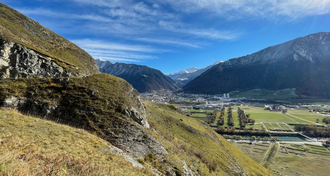
Here the path winds gently up the hill. Continue over pastures and through forest, along the Calanda massif. On the way, there are always wonderful viewpoints of Chur and the surrounding mountains. Various benches invite you to take a break and enjoy the panorama.
Soon you have reached the military target slope Arabüehl above Chur. As soon as you have traversed it, you will continue through a tunnel on a paved road. This leads down, in the direction of Felsberg. At the bottom of unter Neugüter Strasse, the path leads to the left, in the direction of the banks of the Rhine. Along the Rhine it goes back to the starting point in the Upper Au. Alternatively, you can turn right on Unter Neugüter Strasse and walk to Felsberg and end the tour there.
Directions
Public Transport
Obere Au
P+R
By bus from Chur to Haldenstein(abbreviated variant)
Bus line 3 runs regularly from Chur
train station to Haldenstein
Station: Haldenstein, Usserdorfstrasse
Bus line 1 and various Rhaetian Railway
trains run regularly from Felsberg to Chur.
Bus stops: Felsberg, Bahnhof / Felsberg, Calanda
Stop Rhaetian Railway: Felsberg station
Parking
Responsible for this content: Chur Tourism.
This content has been translated automatically.