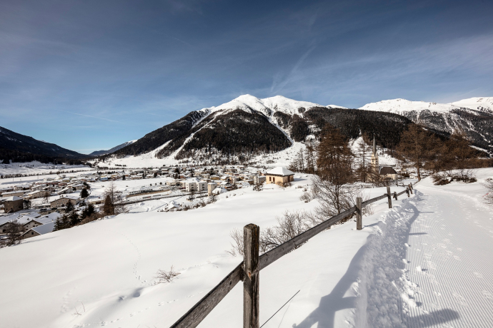
S-chanf-Zernez-Loipe

14 km
1:30 h
240 mhd
420 mhd


Show all 8 images

Cross-country ski trail through the forest from S-chanf to Zernez, an addition to the route of the Engadin ski marathon. It follows the Inn River and mostly runs gently downhill to the gateway of the Swiss National Park.
Best Season
Jan
Feb
Mär
Apr
Mai
Jun
Jul
Aug
Sep
Okt
Nov
Dez
Start
S-chanf
Destination
Zernez
Coordinates
46.618491532286, 10.006243851073
Details
Description
The 15 km long trail is the extension of the Engadin Skimarathon trail from S-chanf to Zernez. It leads on the right side of the Inn River mostly through the forest down to Zernez and includes challenging climbs and descents.
Geheimtipp
Take the train from Zernez to S-chanf and then enjoy cross-country skiing to Zernez, followed by a fine piece of cake on the sun terrace of the Restorant Center da Sport.
Sicherheitshinweis
The trail is groomed several times a week. Please note the condition reports in the winter sports report.
The tour was assessed in favourable weather conditions, current snow and weather conditions must be noted before starting.
Emergency call:
144 Emergency call, first aid
1414 Mountain rescue REGA
112 International emergency call
Ausrüstung
Cross-country skiing equipment, trail pass, sun protection, drinks.
Directions
S-chanf - Prasüras - Val Mela - Carolina Pra da Punt - Centre das Sport
Directions
Public Transport
- With the Rhaetian Railway (from Chur, Landquart/Prättigau, Scuol or Upper Engadine) hourly to Zernez or S-chanf.
- On foot from S-chanf station to the start of the trail (approx. 15 minutes)
Anreise Information
- From the north: via Landquart - Klosters by car transport through the Vereina tunnel (Selfranga - Sagliains) into the Lower Engadine on H27
- From the east: via Landeck / Austria in the direction of St. Moritz on H27
- From the south: via Reschenpass (Nauders-Martina) or Ofenpass (Val Müstair-Zernez) on H27
- Zernez is directly on the Engadine road H27 (15 minutes from Vereina south portal)
Parking
- Free parking available at the Center da Sport (Urtatsch 147A)
- Free parking available in Prà da Punt (exit Zernez direction Ofenpass)
Responsible for this content: Tourism Engadin Scuol Samnaun Val Müstair AG.
This content has been translated automatically.

This website uses technology and content from the Outdooractive platform.


