Salahorn 2984m


Show all 4 images

For those who are looking for even more peace: The Salahorn is a remote and lonely panoramic peak on the border to the rear Rheinwald.
Details
Description
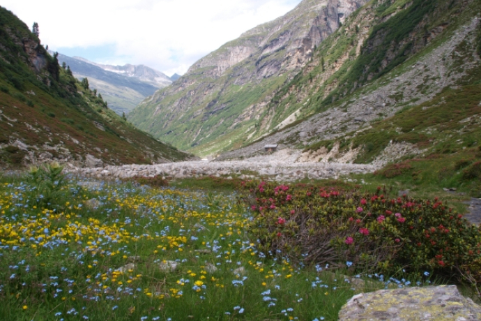
Of the five valleys of the municipality of Vals, the Canal Valley is the least known and least visited. Branching off from Lake Zervreila, wild and steep slopes stretch backwards to the foot of the Güferhorn (3379m), the second highest peak of the ValserTal. On the way in the lonely high valley you may find nothing but the sheep of the Canalalp, which are spread over the extensive valley sides. The mostly easily accessible hiking trail finally leads with the Canallücke (2838m) to the highest, marked pass crossing in Vals. Directly above, the Salahorn offers a spectacular view of the Adula basin (Rheinwaldhorn) and the surrounding mountains on the border with Ticino.
Geheimtipp
The Hohberghorn (3004m) also stands directly above the Canallücke and can be reached by experienced mountaineers in easy, attractive climbing.
Sicherheitshinweis
Requirements: For good mountain hikers technically easy tour (T3), which requires caution in wet, cold and snow in the summit area.
On this hike they have to reckon with suckler cows.
Detailed information about behavior: https://www.wandern.ch/de/wandern/sicher-unterwegs/mutterkuhherden
Ausrüstung
Solid, rainproof, warm clothing. Robust mountain or trekking boots. Gloves, hat, sun protection. Hiking poles, food and drinks from the backpack, emergency pharmacy, topographic map, altimeter, compass, mobile phone, flashlight.
Directions
From the chapel Zervreila (1984 m) the gravel road leads downhill in 30 minutes to the Canal Bridge (1865 m). There turn left before the bridge and for an hour on the hiking trail along the valley floor to the Stafel of the Canalalp (1937 m). From now on for two hours always uphill on the left flank of the valley and climb through a first cauldron, always with a wonderful view of the Güferhorn. Past the Canalsee and finally climbing a scree slope, the Canallücke (2839 m) is reached. Now turn right and climb the summit in a short, half-hour ascent over the simple east ridge. Descent either immediately or via Canallücke to the Zapporthütte SAC in the Rheinwald.
Directions
Public Transport
By PostBus from Vals to Zerfreila (only in summer).
Anreise Information
Via Chur-Ilanz-Vals to Zervreila.
Parking
Parking at the chapel Zervreila.
Responsible for this content: Visit Vals AG.
This content has been translated automatically.

This website uses technology and content from the Outdooractive platform.


