Stage 5: Via Albula/Bernina

Closed
Medium
12 km
4:20 h
800 mhd
780 mhd


Show all 8 images

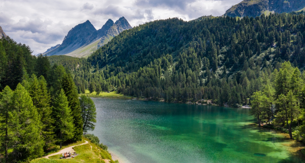
This leg is the highlight of the route, setting off from Preda via the Albula Pass to the southern tunnel portal. The mountain hiking trail passes by the crystal-clear Lai da Palpuogna lake, climbing up to Alp Weissenstein (known as Crap Alv in Romansh) and onward to Fuorcla Crap Alv. This is followed by a steep descent into the Val Bever valley until you reach the idyllic Spinas, your destination for this leg.
Best Season
Jan
Feb
Mär
Apr
Mai
Jun
Jul
Aug
Sep
Okt
Nov
Dez
Start
Preda
Destination
Spinas
Coordinates
46.589070898253, 9.774864341379
Details
Description
Along the «King's Stage» from northern Italy to the southern portal of the tunnel and over the pass. The mountain hike leads past the crystal-clear Palpuognasee lake, over Weissenstein Alp or Crap Alv up to the Fuorcla Crap Alv (2466 m altitude) and steeply down into Val Bever to the idyllic stage destination of Spinas.
Geheimtipp
Beware: snowfields possible into summer months on high-level sections
Responsible for this content: SwitzerlandMobility.
This content has been translated automatically.


