Surlej - Lej Nair - Lej Marsch
Simple
5.9 km
1:45 h
168 mhd
168 mhd


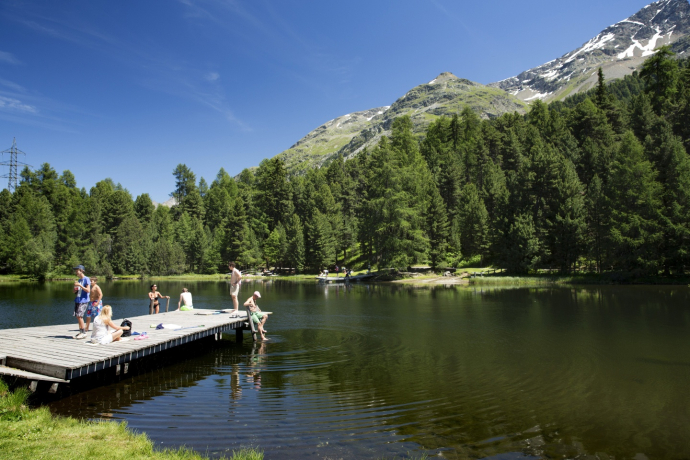
Leasure hike to the small moorland lakes of Lej Nair and Lej Marsch, where barbecue sites and wood are available for a delicious lunch. Water lovers will love the lakes for a dip in the cool water.
Best Season
Jan
Feb
Mär
Apr
Mai
Jun
Jul
Aug
Sep
Okt
Nov
Dez
Start
Surlej bridge
Destination
Surlej bridge
Coordinates
46.459951, 9.803252
Details
Description
The satrting point is the Surlej bridge. The path leads through the woods, over Crest'Alta, towards St. Moritz and to the mystical Lej Nair. At this little moor lake, barbecue sites and various benches invite visitors to stop and linger for a while. Alternatively, you can take a leisurely stroll along the walkway around the lake; with a little luck, you might spot a dragonfly or two. The path continues over a few tree roots down to the Lej Marsch. This lake is particularly popular for bathing and features a number of barbecue sites. After a leisurely rest, the trail leads to Lake Champfèr and back to Surlej on the southern shore. Those who do not want to walk all the way back to Surlej can make their way past the Olympic ski jump and down to the main road, where the bus will take them from the “Campingplatz” (campsite) bus stop back to Surlej.
More information
Engadin Tourismus AG
Via Maistra 1
CH-7500 St. Moritz
Phone: +41 81 830 00 01
E-mail: allegra@engadin.ch
Internet: www.engadin.ch
Geheimtipp
Do not forget to bring with you your bathing costume
Directions
Surlej bridge - Crest'Alta - Lej Nair - Lej Marsch - Lake Champfèr - Surlej bridge
Directions
Public Transport
With the Engadin Bus to bus stop Surlej Brücke
Responsible for this content: Engadin Tourismus AG.

This website uses technology and content from the Outdooractive platform.


