Winterwandern: Surrein - Resgia (Cumpadials)


Show all 4 images

This hike leads through the valley of Surrein and later along the Rhine.
Details
Description
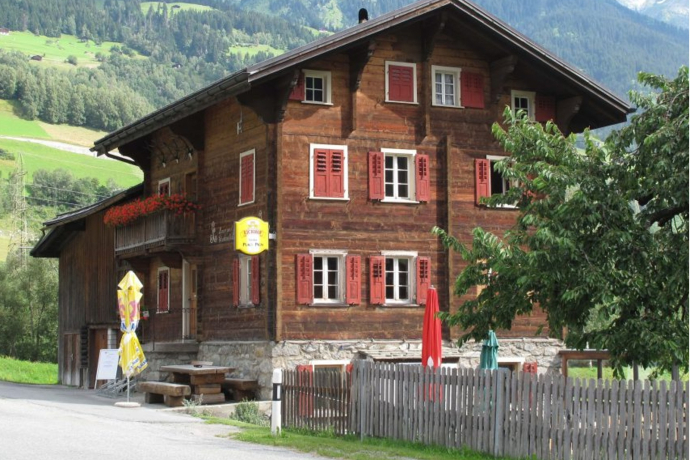
The hiking trail starts on the eastern edge of the village of Surrein, at the Placi Pign restaurant. You walk along the elongated village of Surrein, partly parallel to the cross-country ski trail "Nordic Surselva". Continue through Giachentrina and Reits until you reach the end of the plain. From here you can walk to the "punt Gonda" bridge, which crosses the Rhine. On the left side of the Rhine you can continue along the Rhine. The cross-country ski trail also runs through here and we ask winter hikers to be considerate of cross-country skiers and the trail. The further path leads to a hill and then to the Resgia, a detached house with an annex, which used to be operated as a sawmill. A little further on you reach the road that leads towards Cumpadials. From here you can reach Cumpadials in a short time.
The winter hiking trails Sumvitg - Runs - Rabius / Rabius - Surrein and Surrein - Resgia (Cumpadials) can be combined to form the Las Squadras trail.
Please note the current signage regarding any path closures.
Geheimtipp
Visit to the Sogn Benedetg Chapel in Sumvitg. Designed by renowned architect Peter Zumthor.
Sicherheitshinweis
In case of uncertain weather conditions, the tour should not be started. Weather changes in the mountains are frequent. If a snow front or similar comes up during the hike, you should turn back in time.
144 Emergency call, first aid
1414 Mountain rescue REGA
112 International emergency number
Ausrüstung
Winterproof shoes and clothing are a must. Sun protection, headgear and hiking poles are an advantage.
Directions
Along the Rhine from Rurrein to Recgia (Cumpadials)
Directions
Public Transport
By train via Chur or Göschenen
From Göschenen via Disentis or from Chur directly with the RhB to Rabius and then on to Surrein.
Anreise Information
By car via Chur
From Zurich on the A3 or from St. Gallen on the A13 to Chur and continue to the Reichenau exit in the direction of Disentis/Ilanz/Flims to Surrein.
By car via Göschenen (Oberalp Pass closed in winter)
From Basel, take the A2 via Lucerne to Göschenen, continue on the old pass road through the Schöllenen Gorge to Andermatt and over the Oberalp Pass/Disentis to Surrein.
Parking
At the restaurant Placi Pign there are several parking spaces. At the church square in Surrein there is a large parking lot.
Responsible for this content: Surselva Tourism.
This content has been translated automatically.

This website uses technology and content from the Outdooractive platform.
