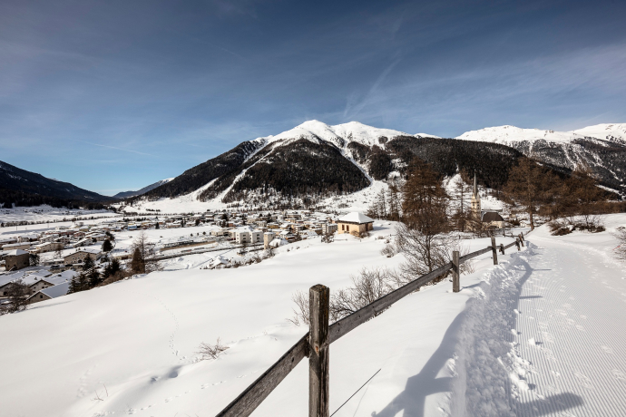
Zernez - Giarsun
Closed
Medium
6.2 km
0:40 h
3 mhd
39 mhd


Show all 4 images

Varied cross-country ski run along the Inn River, with constantly changing terrain in the upper part of the Lower Engadine with connection to the Engadine Marathon Run. The ski run crosses the villages of Zernez, Susch, Lavin and Giarsun and can therefore be divided into stages as desired.
Best Season
Jan
Feb
Mär
Apr
Mai
Jun
Jul
Aug
Sep
Okt
Nov
Dez
Start
Zernez
Destination
Susch
Coordinates
46.705219, 10.093051
Details
Description
From Zernez the ski run initially leads across the snow-covered plains above the Inn at the eastern end of the village. Shortly after the Chasuot farm, the valley narrows considerably and you enter the forest. The trail now runs directly along the Inn, and after a few small ascents and descents through the forest you again reach open terrain before arriving in Susch. In Susch you cross the village on foot for a few metres. After Susch you soon reach a small wooded area and a short ascent follows. The ski run continues mostly along the edge of the forest to Lavin and on over the beautiful fields near Planturen and Cuas. Shortly before you reach Giarsun the trail leads down to the Inn and after crossing the river on the other side of the valley back up to Giarsun, the end point of the ski run. If you wish, you can add the additional loop below Guarda train station as another highlight.
Geheimtipp
- Refreshments in Zernez, Susch and Lavin
- Night ski run in Zernez
Sicherheitshinweis
The trail is regularly groomed when conditions are good. Please note the condition reports in the winter sports report. The tour was assessed in favourable weather conditions, current snow and weather conditions must be noted before starting.
Emergency call:
144 Emergency call, first aid
1414 Mountain rescue REGA
112 International emergency call
Ausrüstung
Cross-country skiing equipment, trail pass, sun protection, drinks, if required: ticket or money for the return journey by public transport.
Directions
Bahnhof Zernez
Chasuot
Susch
Directions
Public Transport
- By Rhaetian Railway (from Chur, Landquart/Prättigau, Scuol or Upper Engadine) hourly to Zernez
Anreise Information
- From the north: via Landquart - Klosters by car transport through the Vereina Tunnel (Selfranga - Sagliains) or via the Flüela Pass into the Lower Engadine on H27
- From the east: via Landeck / Austria in the direction of St. Moritz on H27
- From the south: via Reschenpass (Nauders-Martina) or Ofenpass (Val Müstair-Zernez) on H27
- Zernez and Susch are directly on the Engadine road H27 (5-15 minutes from Vereina south portal)
Parking
- Paid parking spaces at the railway station in Zernez
- Paid parking spaces at the railway station in Susch
Responsible for this content: Mals/Burgeis-Schluderns-Glurns.

This website uses technology and content from the Outdooractive platform.


