Circular walk around Stelsersee


Show all 3 images

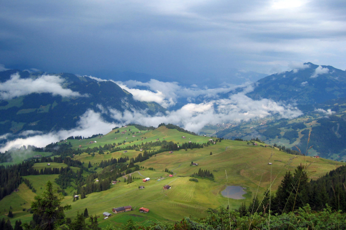
At the end of the last ice age, enormous natural forces created the conditions for the formation of Lake Stelsersee. Today, the lovely mountain lake is characterized by valuable siltation zones and a rich flora and fauna. It is protected.
Details
Description
The starting point of the leisurely hike is the Postbus mountain station Mottis in Stels. The hike leads uphill on a little-used, tarred mountain road towards Stelserberg. The alternative to the tarred road is a hiking trail that leads to the lake after a few hundred meters of road via Mataun and Cug to the Berghaus (a little more difference in altitude and travel time, but more scenic).
If the Berghaus zum See takes your breath away, it's not because of the ascent so far, but rather because of the incomparable panorama of the Rätikon chain! The Schweizertor, which allows high-altitude hikers to cross over to the Austrian Montafon, is nowhere better to marvel at. It's up to you whether you want to stop for a bite to eat, most of the time the temptation of the wonderful terrace and the taste of the fresh cakes is too great...
To the Stelsersee, continue along the road for 200 m, then turn left onto a gravel road. From here you can reach the lake in 15 minutes.
Lake Stelsersee, which is a nature reserve, is known for its insect diversity. Rare dragonflies with evocative names such as the Little Moss Maiden or the Spear Azure Maiden can be found here. And when it comes to plants, many a height record can be recorded: in addition to the white water lily, nowhere else in Graubünden does the sea rush thrive as high up as at Lake Stelsersee.
Pro Natura Commitment: Since 1947, Pro Natura has been committed to the preservation and protection of the unique mountain lake, and since 1972 the organization has been the owner of Lake Stelsersee. Today, the protected area covers an area of about 7.2 ha.
Please observe the rules of conduct: Do not leave signposted paths and paths. Keep dogs on a leash. No camping or bathing. Do not capture, disturb, track or use animals. Do not pick, uproot and plant plants.
To complete the round trip, take the road below the lake in the direction of Pardiela and from Fulried you return to the starting point Stels, Mottis.
Geheimtipp
The accessibility in the month of May depends on the level of snowmelt.
Ausrüstung
Trekking or hiking boots are ideal, for this tour sneakers are also fine in dry weather. Possibly backpack with drinks and a small snack.
Directions
Mottis - Mataun - Cug - Berghaus zum See - Stelsersee - Fulried - Mottis.
Directions
Public Transport
You can reach the Prättigau holiday region comfortably and easily by public transport. Travelling to Landquart by train is no problem thanks to national and international fast connections. In Landquart you can change directly from the SBB (Swiss Federal Railways) to the modern train composition of the RhB (Rhaetian Railway), which takes you to Schiers. After changing to the buses of PostBus Graubünden, you will reach the Stelserberg (stop Mottis) within 25 minutes.
Anreise Information
Coming from Zurich on the A3 and from Sargans on the A13 towards Chur. Take exit 13 Landquart in the direction of Davos. After the tunnel, follow the A28 national road to Schiers. Take the first exit and follow the signs for Stels. Coming from St. Gallen, take the A13 towards Chur. Take exit 13 Landquart in the direction of Davos. Coming from the south, take the A13 towards Zurich. Take exit 13 Landquart in the direction of Davos. Coming from the Engadine, take the A28 national road towards Landquart. Take the first exit in Schiers and follow the signs for Stels in the village.
Parking
Responsible for this content: Prättigau Marketing.
This content has been translated automatically.

This website uses technology and content from the Outdooractive platform.
