High above the Bündner Rheintal - Valzein circular route


Beautiful, easy alpine hike (T4) in the solitude of the easily accessible Valzeina Valley. On the way over the rock faces of the Chur Rhine Valley, the impressive view over the Rhine Valley and the Bünder Herrschaft remains in the memory even after the hike.
Details
Description
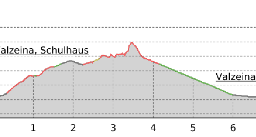
From the village centre of the Walser village of Valzeina, which is easily accessible by public transport, the path leads over green slopes directly up to the Tritt. Anyone who has ever looked at the steep rock faces on the drive through the Chur Rhine Valley will certainly have noticed the large transmission mast. This is the next corner point of the route - the way to the Mittagsplatte, where the transmission mast stands, is easily accessible and the view is worthwhile. Warmed up, you now start into the more difficult section of the path (T4) - sure-footedness and a head for heights are prerequisites for enjoying the tour to the fullest. The narrow path runs along the ridge and offers a magnificent view over the Grisons Rhine Valley. The final ascent to the Medli leads through a steep, but well secured mountain flank. The last piece to the highest point is pathless. The descent takes place only on a mountain hiking trail which soon leads into a road. Follow this in the direction of Ober Clavadätsch and pass farms and Maiensässen back to Valzeina, the starting point.
Geheimtipp
Take a fine souvenir with you in Maria Heinz-Walli's farm shop or end the tour in the Dorfbeizli.
Sicherheitshinweis
The trail is classified as T4 (alpine hiking) according to hiking scale SAC. If marked: white-blue-white
Path / terrain: Route partly pathless, terrain partly quite exposed.
Requirements: Familiarity with exposed terrain, sturdy trekking shoes.
In wet conditions, the path should be avoided.
Ausrüstung
Sturdy mountain boots, mountain hiking clothing adapted to the season. An up-to-date hiking map in your backpack is just as advisable as sun, rain and heat protection, water bottle and tour provisions. Touring poles increase sure-footedness and relieve the joints. For emergencies: first aid kit, rescue blanket, mobile phone.
Directions
Valzeina - Tritt - Mittagsplatte - Sturnenboden - Medli - Oberclavadätsch - Engi - Eggen - Valzeina
Directions
Public Transport
Depending on the time of day with the Bahn to Landquart or Grüsch. Continue by post bus to Valzeina, Kirche.
Anreise Information
Parking
Responsible for this content: Prättigau Marketing.
This content has been translated automatically.

This website uses technology and content from the Outdooractive platform.