Panoramawanderung zwischen Piz Mundaun und Péz Sezner


Show all 11 images

Panoramic hike with a unique view of the holiday paradise Surselva. The hike can be started on foot, by hiking bus or by chairlift from various locations.
Details
Description
An all-round view like the one found on the Piz Mundaun is extraordinary. Numerous mountain ranges join together in the distance to form the Alpine massif. It is not for nothing that it is also called the "Graubünden" Rigi and is considered one of the most beautiful panoramic mountains in Switzerland. The hiking trail leads from summit to summit, so that the individual mountain peaks form stage destinations along the way. Whether it's straight up, down or straight ahead, the view doesn't disappoint once. On the Péz Sezner, in addition to the obligatory summit cross, there is also a summit book in which tired but happy hikers can sign their names.
The hike can be started on foot, with one of the three mountain railways or with one of the hiking buses from various points. Some suggestions:
From Meierhof:
On foot or by hiking bus to the Wali middle station. Take the cable car to the Stein or hike up to Péz Sezner.
From Misanenga:
Hike to Punkt 2002, between Stein and Hitzeggen.
From Surcuolm:
On foot or by hiking bus to the middle station Cuolm Sura. Ride on the cable car or hike to Piz Mundaun
From Vella:
On foot or by hiking bus to the Triel middle station. Ride on the cable car or hike to the Hitzeggen
Take the hiking bus from Vella to Alp Sezner.
From Morissen:
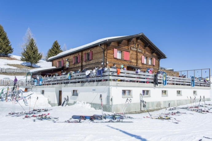
Hike towards the forest of S. Carli. After crossing the forest, at the Bündner Rigi restaurant, the hiking trail to Piz Mundaun begins.
From Lumbrein:
Hike to Péz Sezner.
Geheimtipp
At the viewing platform on Piz Mundaun, most of the peaks can be located with the help of the panorama board.
Scooter descent from Cuolm Sura (Piz Mundaun valley station) to Platenga, Meierhof or Affeier. Fun for young and old and a nice end to the hike if you approach the tour the other way around.
Sicherheitshinweis
In uncertain weather conditions, the tour should not be started. Weather changes in the mountains are frequent. If a rain front or similar comes up during the hike, you should turn back in time.
Ausrüstung
Good hiking boots with good tread, weather-appropriate clothing (rain jacket), first aid kit, drink, food, ev. Hiking poles.
Directions
Piz Mundaun - Hitzeggerkopf - Stein - Péz Sezner
Descents with trains and shuttle buses, see description.
Directions
Public Transport
Postbus line 90.441 Ilanz - Vrin
Hiking bus bus Lumnezia (please note timetables):
-Vella - Triel middle station
- Vella – Péz Sezner
Bergbahnen Triel – Hitzeggen (please note travel times)
Postbus line 90.451 Ilanz – Obersaxen
Hiking bus Obersaxen Mundaun (please note timetables)
- Meierhof – Wali
- Meierhof – Cuolm Sura
Bergbahnen Wali – Stein, Cuolm Sura – Péz Mundaun (please note timetables)
Anreise Information
Via Chur A3/A13 via Flims to Ilanz. From Ilanz to Obersaxen, Mundaun or Val Lumnezia.
Parking
Parking is available at the valley stations of the cable cars and in the various villages.
Responsible for this content: Surselva Tourism.
This content has been translated automatically.

This website uses technology and content from the Outdooractive platform.


